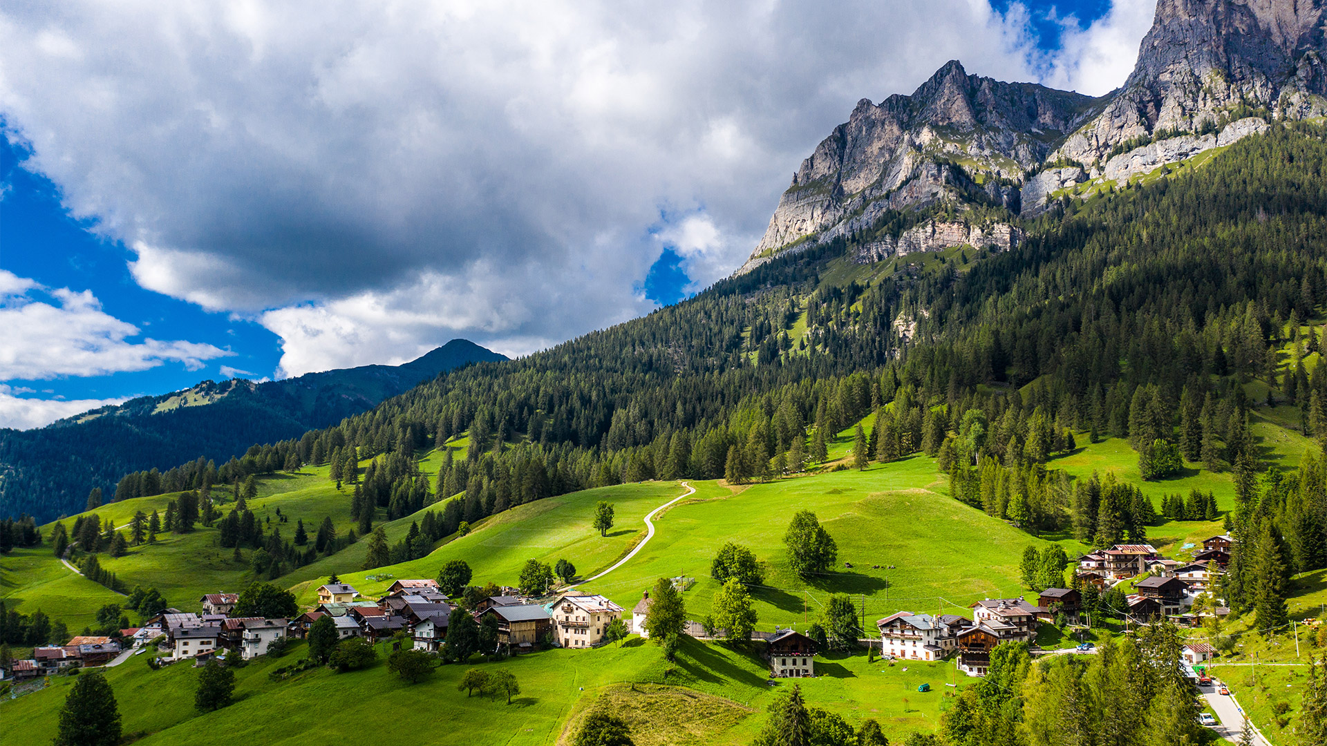

Summer in Val Fiorentina
There are countless activities to do in the local area: In summer guests can enjoy walks and excursions, cultural and archaeological itineraries, such as to the nearby First World War military posts in the Lagazuoi/Cinque Torri area, the Alta Via no.1 walking path, itineraries to the Mesolithic site of Mondeval de Sora and the Mandriz Neolithic site where finds of recognised international importance were brought to light.
The are various, captivating mountain-bike trails, via ferratas and ascents. It is also possible to fish in our clear streams and do numerous other sports in the new Sports Centre in the hamlet of Santa Fosca (with a seven-a-side football pitch, basketball, volleyball and tennis courts and a large children’s playground).
In every corner of the valley, you can find restaurants, mountain huts and farmsteads where you can try typical local dishes from Ladin cuisine: homemade recipes with the aromas of the past made with speck, game, mushrooms and dairy products from our Alpine pastures.
Culture is an integral part of the area. The Val Fiorentina “V. Cazzetta” Civic Museum is home to archaeological, geo-palaeontological and historical finds discovered in the valley and the surrounding area. Examples of the most important discoveries on an international level are the burial site with the “Skeleton of the Mondeval Man” dating back to the VI millennium BC and fossils from Mount Pelmetto with different species of dinosaur footprints (the first and oldest in Italy).
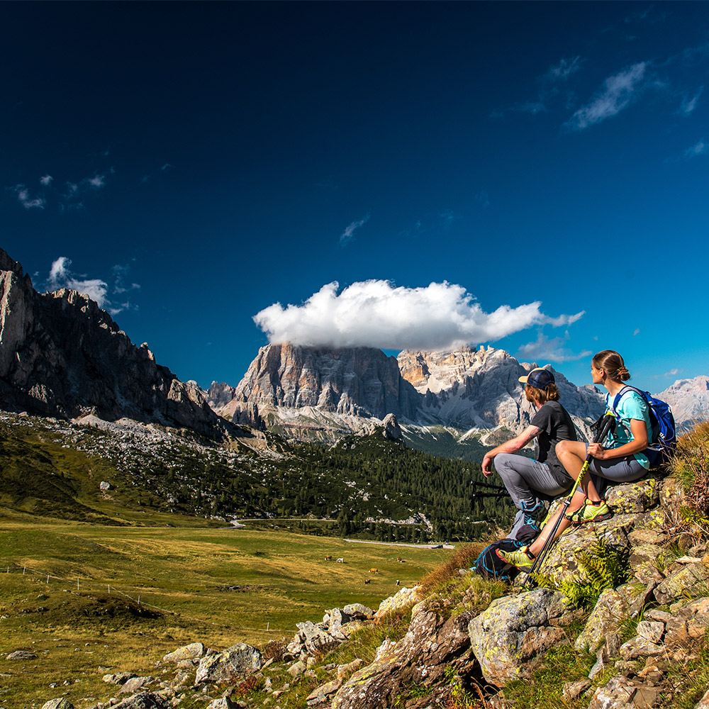
Walks through the valley
There are numerous walks for all needs to discover the local area. These are easy routes also suitable for children that nevertheless allow you to enjoy the fantastic scenery and the quiet of our woods.
With the ski lifts open in the summer in the months of July and August you can reach high altitudes easily which provides the possibility for everyone to enjoy the fantastic panorama.
At the Tourist Office you can find special maps with all the information about our suggestions, with all details of walking times and the varying levels of difficulty of all the walks to be able to satisfy all visitors especially those discovering the Dolomites UNESCO world heritage site for the first time.
This route starts from the hamlet of Santa Fosca and then climbs to L’Andria. Continue along the asphalt road towards the Malga Pien de Vacia Farmstead (where it is possible to buy typical products). From the farmstead you can return to Santa Fosca the same way or take the path on the right just after the farmstead that takes you through the woods down to Santa Fosca.
easy
Difficulty
1 h 45 round trip
Duration
5 km
Length
The route starts in Pescul at the end of the car park to the chairlift. This is a nice walk in the woods on a dirt track to the Ristoro Fertazza. For those more expert there is the possibility to reach the Ristoro Belvedere at the top of Mount Fertazza where you can take in the 360-degree panorama. During the summer it is also possible to reach the top with the chairlift.
easy - medium
Difficulty
3 h round trip to the Fertazza Mountain Hut
Duration
1 h 30 min. round trip to the Belvedere Mountain
Duration
4 Km to the Fertazza Mountain Hut
Length
+ 2 km to the Belvedere Mountain Hut
Length
The route starts at the first hairpin bend after the Staulanza Pass in the direction of Zoldo. This dirt track leads through charming scenery immersed in nature. Being flat it is particularly suitable for small children and families with strollers. Once you reach the Malga Fontanafreda Farmstead and the Malga Vescovà Farmstead it is also possible to purchase typical local products.
easy
Difficulty
1 h 30 min. round trip
Duration
2 Km
Length
This route starts from the last house in the hamlet of Pescul. This walk that takes you from Pescul to the Aquileia Mountain Hut is easy and suitable for everyone. Along the route you pass through mountain streams, pastures where cows and horses graze freely and picnic areas to reach the Aquileia Mountain Hut where you can get great views of Mount Pelmo.
easy
Difficulty
2 h round trip
Duration
2,50 km
Length
This route starts from the Aquileia Mountain Hut crossing the plain in front of the Mountain Hut and then passes a stream coming from the Mondeval area. From here take the path that crosses the woods to the Malga Fiorentina Farmstead. Continuing along the forest-pastoral road you quickly reach the Città di Fiume Mountain Hut in front of Mount Pelmo. A 15-minute walk from the Mountain Hut takes you to the shrine of St. Anthony near to Forcella Forada.
medium - easy
Difficulty
3 h round trip
Duration
3 Km
Length
This route starts from Santa Fosca and climbs towards L’Andria. Once you reach the ancient hamlet turn right towards the Malga Pien de Vacia Farmstead. The asphalt road climbs slightly to the farmstead and then flattens out until Pierà de L’Autà. The descent starts here that leads to Palui near the picnic area. Once you reach the bottom keep right on the path that crosses the pastures to reach Pescul and then onto Santa Fosca.
easy
Difficulty
3 h 30 min.
Duration
9 Km
Length
The route starts in the village of L’Andria. Cross through the village where you can admire the ancient haybarns and characteristic houses. Once you pass the charming church of St. Oswald take the asphalt road on the right that leads up to cross the pastures above L’Andria. After the initial climb, the road flattens out through the woods and then goes down towards Zardin - Rova. The last part of the route follows the main road and returns to the hamlet of L’Andria.
medium
Difficulty
2 h 30 min. in a circle
Duration
5 Km
Length
Crossing the Ancient border between Italy and the Austro - Hungarian Empire
The route starts in Piazza San Lorenzo, the main square in Selva di Cadore. The path climbs through Monec and crosses the pastures in Zanata. From here the path flattens out until the crossroads with the main road that leads to Giau Pass. Continue for a short time on the main road until you reach a small road on the right that leads to Posalz, a typical village in the Municipality of Colle Santa Lucia. Continue on the Strada dei Siori from Posalz that leads to the village of Pian di Colle Santa Lucia and descend to Codalonga where once there was the border between Italy and the Austro-Hungarian Empire. Continue on a slight climb to return back to Selva di Cadore.
easy
Difficulty
2 h in a circle
Duration
6 Km
Length
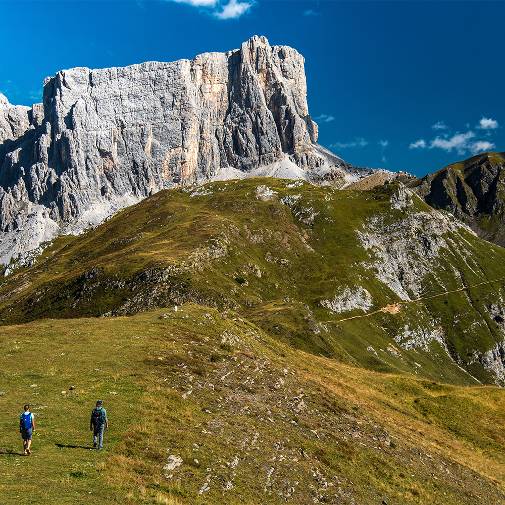
Trekking itineraries
Val Fiorentina has numerous excursions suitable for both the more experienced and trained as well those trying hiking for the first time on mountain paths.
Starting points are all over the area, both from the centre of small hamlets and villages or areas that can be reached by car or bus in a few minutes. In the months of July and August the chairlifts are open which also provides the possibility for everyone to enjoy the fantastic panorama at high altitude.
The main Dolomites included are: Mounts Pelmo, Civetta, Averau, Nuvolau, Marmolada, Pore and the Cernera Chain.
Before setting off on an excursion take a look at the weather forecast, wear suitable clothing, take equipment, and request information from the Alpine Guides if necessary.
The route starts in the large car park at the foot of Mount Pelmo at the third hairpin bend to the Staulanza Pass. From here there is a dirt track that leads first to the Malga Fiorentina Farmstead and then onto the Città di Fiume Mountain Hut at an altitude of 1,918 m above sea level where you can admire Mount Pelmo in all its majesty. The ancient way to Cadore continues towards Forcella Forada at an altitude of 1,977 m above sea level where you can admire the Boite Valley and the peaks surrounding it. Just after the top of Forcella there is a shrine on the left dedicated to St. Anthony. Legend says it was built after a traveller who was caught in the storm made a vow to the Holy Protector. Descent is along the same route.
easy
Difficulty
2 h one way
Duration
4 Km
Length
This route starts on forestry - pastoral road no. 569 at the end of the car park to the chairlift in the hamlet of Pescul and climbs through the predominantly fir tree wood to the Fertazza Mountain Hut at an altitude of 1,839 m above sea level. Once you pass the Mountain Hut and the second chairlift station the path leads into a fir and larch tree wood and then shortly after veers to the left where you start to climb through pastures and ancient huts. Once you arrive at the top of Mount Fertazza at an altitude of 2,101 m above sea level instead of turning left towards the Belvedere Mountain Hut turn right along path no.566 with the famous North-West walls of Mount Civetta and majestic Mount Pelmo behind you and the Queen of the Dolomites Mount Marmolada and the Sella Group in front of you. Walking through high mountain meadows and rhododendrons you quickly reach a stone where you can find the Madonnina Bianca of Mount Fertazza.
easy
Difficulty
2 h 45 min. one way
Duration
6 km
Length
Leave your car at the Staulanza Pass at an altitude of 1,768 m above sea level and take path no.472 that after about a 30-minute walk among fir trees and mountain pines leads to the crossroads with the path on the left that leads to the Dinosaur Footprints. For those interested in visiting the site follow the path that zigzags up (that can be slippery if if it has rained in the previous days) and leads to the rock where the Footprints of Triassic Dinosaurs were found. From here on the same path go back to the crossroads and continue on the path that leads to the Venezia Mountain Hut. The path goes up and down and crosses through some meadow areas in the shadow of Mount Pelmo. At the end, a short climb leads you to the Venezia Mountain Hut at an altitude of 1,946 m above sea level.
medium - easy
Difficulty
3 h 30 min. one way
Duration
6 km
Length
From Selva di Cadore go to the Fedare Mountain Hut at an altitude of 2,000 m above sea level by car taking the road that leads to the Giau Pass. On foot take the mule track signposted as path no. 464 that leads to the Averau Mountain Hut at an altitude of 2,413 m above sea level. Alternatively, it can also be reached with the chairlift. Just after the Mountain Hut the path leads east and climbs on rocky terrain towards the Nuvolau Mountain Hut. From the top of Mount Nuvolau at an altitude of 2,575 m above sea level you can enjoy the view of the Ampezzane Dolomites and the Agordine Dolomites.
medium
Difficulty
2h one way
Duration
3,50 km
Length
(L’Andria - Mondeval - Lago De Le Baste - L’Andria)
This route starts from the hamlet of Toffol - L’Andria and the first part is on an asphalt road that climbs slowly to reach the village of Piera de L’Auta at an altitude of 1,756 m above sea level. From here take path no. 466 on the left and continue walking to cross the Cordon stream and climb up a slope to pastures in Mondeval de Sora where you reach the rock where the Mondeval Man was discovered at an altitude of 2,158 m above sea level. This is the place of the important and famous burial ground of the Mondeval Man, a hunter who lived around 7,500 years ago. The perfectly preserved skeleton of our ancestor, along with all the funerary objects found in the tomb can be admired at the Civic Museum in Selva di Cadore. Once you pass the rock continue up until you reach path no.436 (ALTA VIA N.1) and continue towards Forcella Giau along the slopes of Lastoi de Formin. Cross through the pastures where the Mondeval Man used to hunt, and you will find a small lake called Lake de le Baste. Just after the lake take path no.465 on the left down that leads to the beautiful Busa dei Ciavai basin between the Piz del Corvo and del Cernera mountains. Continue onwards through Ponte di Sassi and Sas Strenc until you enter the woods. After a long descent you reach the first houses of the village of L’Andria and from here you can reach Santa Fosca easily.
medium
Difficulty
5 h 30 min. in a circle
Duration
10 km
Length
This excursion passes through the area between Mount Civetta, Mount Pelmo, Mount Croda da Lago and the Giau Pass Area which are the first of the nine UNESCO Dolomite systems. The route that starts from the village of L’Andria goes up the asphalt road passing next to the Malga Pien de Vacia Farmstead and reaches Piera de L’Auta at an altitude of 1,756 m asl where you find a crossroads and then take path no.466. Initially this path follows the Rio Cordon, passes through Casera Mondeval di Sotto and a little further on passes over a footbridge over the Rio Cordon. Here the path starts to get steeper until you reach the plateaus of Mondeval de Sora. Then continue north towards Forcella Ambrizzola at an altitude of 2,277 m asl. In the distance on the left, you can see the boulder under which the remains of the Mondeval Man were found. Once you arrive at the ridge between Lastoi de Formin and Bec di Mezodì take path no.434 down along the slopes of Croda da Lago until you reach the Palmieri Mountain Hut and its lake at an altitude of 2,046 m asl. This place is famous for being one of the most beautiful in the Dolomites.
medium
Difficulty
3 h 30 m one way
Time
8 km
Length
This beautiful excursion takes you to Lake delle Baste and the high plateaus in Mondeval. The route starts from the Giau Pass on path no.436 of the Alta Via no. 1. The terrain is initially flat and passes through alta Val di Zonia through Forcella Col Piombin at an altitude of 2,239 m above sea level; it then descends passing by some rocks and then climbs again to an altitude of 2,360 m above sea level to Forcella Giau Pass. From the ridge you can admire spectacular views of Mount Tofane and the 5 Torri. In front of you is the high plain of Mondeval de Sora and continuing through the pastures you reach your destination of Lake de le Baste. Pass by some large rocks that detached from Lastoi del Formin called the “City of Rocks” and you reach the lake. Mount Pelmo reflected in the lake will leave you speechless and a photo is the order of the day. From here is it easy to reach the Mesolithic burial site of the Mondeval Man and then return to path no. 436.
medium
Difficulty
3 h 30 m one way
Duration
4 km
Length
This excursion suitable for trained walkers in part crosses the Mount Cernera chain and takes you to places that are off the beaten track and that have remained wild, where the undisputed masters are silence and nature. Leave the hamlet of Toffol and take the forest road that climbs through the woods. Once you cross the bridge over the Rio Giros on the right is the Neolithic site of Mandriz where numerous finds belonging to the Neolithic age were found such as flint artefacts and ceramic pottery. Continue to climb until you reach path no.465. Continue up a steep slope crossing by the “Sas Strenc” where sheep were once passed through for counting. At the top you pass by the “Ponte di Sassi”, a rock formation the Rio Loschiesuoi flows under at an altitude of 2,115 m above sea level. A little further on you enter the Busa dei Ciavai basin. Here leaves path no.465 that leads to Forcella Giau and continue right climbing the valley between Piz del Corvo and Mount Mondeval. Given that there are few people in this area it is the ideal habitat for chamois. Once you reach the top you can choose to go up to the top of Piz del Corvo at an altitude of 2,381 m above sea level where you can admire the fantastic views over the whole of Val Fiorentina or descend towards the ruins of Casera Vallazza at an altitude of 2,138 m above sea level. This part of the path crosses meadows and high mountain pastures until you reach Piera de L’Auta at an altitude of 1,756 m above sea level after passing through Casera Mondeval di Sotto. Once you arrive at the asphalt road continue towards Toffol - L’Andria. Here it flattens out passing by the Malga Pien de Vacia Farmstead and brings you back to the starting point.
medium - difficult
Difficulty
5 h 30 min. in a circle
Duration
9 km
Length
From the Staulanza Pass at an altitude of 1,766 m above sea level take path no.472 on the right towards the Venezia Mountain Hut. The first part of the excursion winds through dense fir tree and mountain pine woods up and down and along the scree slopes of Mount Pelmo until you reach the Venezia Mountain Hut at an altitude of 1,946 m above sea level. Once you pass the Mountain Hut the route becomes more challenging: path no.480 “Flaibiani” starts to climb along the scree and crosses some steep points where there is a wire rope and zigzags until you reach Forcella Val d’Arcia at an altitude of 2,476 m above sea level. From here a steep descent takes you past Val D’Arcia and diagonally across the scree of Mount Pelmo. Go back into the woods and you will soon arrive at the starting point at the Staulanza Pass.
difficult
Difficulty
6 h in a circle
Duration
12 km
Length
The starting point for this easy excursion is at the top of the Staulanza Pass right behind the Staulanza Mountain Hut. Take the mule track that climbs up some hairpin bends along the grassy ridges to reach a crest where you can admire all of Val Fiorentina and the surrounding Dolomites. Then climb again passing under some rocky cliffs to reach another wider ridge where you can admire Mount Pelmo (3,168 m above sea level) so close in all its magnificence you can almost touch it. Proceed paying a little more attention along a short ramp of rocks that ends at the top among thick scented mountain pines. This breath-taking 360-degree panorama allows you to admire the main peaks in the Dolomites: Mounts Pelmo, Civetta, Marmolada, the Sella Group, Antelao, Becco del Mezzodì.
medium - easy
Difficulty
2 h 30 mi. round trip
Duration
5,50 km
Length
This excursion takes you to the top of Mount Pore at an altitude of 2,405 m above sea level. This legendary mountain was important for iron extraction and there were numerous mines all over the mountain (the Fursil Mines). Leave the car at the Fedare Mountain Hut at an altitude of 2,000 m above sea level and follow path no.463 that climbs slightly through meadows and pastures. Once you pass the crossroads with the path leading to the Averau Mountain Hut the route becomes steeper and runs along the ridge of the mountain. The last part leading to the top of the mountain is more challenging.
medium
Difficulty
2 h one way
Duration
2.50 km
Length
Cycling
The Dolomites and the passes that cross through them are some of the most spectacular scenarios to ride on for cycling enthusiasts. Val Fiorentina is the ideal starting point for those who love two-wheels. The climb to the legendary Giau Pass, one of the most fascinating and historic passes in the Dolomites, used many times by the Giro D’Italia and the Maratona dles Dolomites, starts just outside the village. There are numerous other itineraries that start in Selva di Cadore and cross through some of the most famous Dolomite passes such as Pordoi, Fedaia, Duran, San Pellegrino, Val Parola and Falzarego.
This tour around the Civetta - Moiazza Group is one of the most fascinating. From Selva di Cadore descend towards Caprile and turn left towards Alleghe at the foot of the Civetta. The road continues down until Cencenighe and then flattens out until Agordo. Once you pass through Agordino turn left and start the ascent to the Duran Pass at an altitude of 1,605 m above sea level. The climb is challenging, passing through the village of La Valle Agordina and continues to climb until you reach the top between the Massifs of Moiazza and San Sebastiano. Descent towards the village of Dont in some places is very technical as the road is not very wide. Once you reach the bottom turn left and start climbing again, first towards Val di Zoldo and then onto the Staulanza Pass (1,766 m above sea level). With the Civetta on the left and Mount Pelmo on the right you arrive in Forcella Staulanza then descend some hairpin bends until you return to Val Fiorentina.
70,3 km
Length
1354m
Starting altitude
Staulanza Pass 1,766 m asl
Altitude
Duran Pass 1,605 m asl
Altitude
The Giau Pass also called King Giau is one of the hardest passes in the Dolomites that has been used many times in the Giro D’Italia and in the Maratona delle Dolomiti. The ascent to the Pass starts just a few metres outside Selva di Cadore: the challenging first part winds its way through a fir tree wood, climbing up past some avalanche barriers and passes the Fedare Mountain Hut on the left. The next part is less challenging but should not be underestimated. The panorama along the route is unique. To the north there is the Averau - Nuvolau Group and to the south Mount Marmolada until you reach the top of the Pass at an altitude of 2,236 m above sea level where the panorama opens out to the Ampezzane Dolomites Croda da Lago, Lastoi de Formin and Mount Civetta.
10.1 km
Length
1,314 m asl
Starting altitude
2,236 m asl
Arrival altitude
922 m
Elevation gain
16%
Maximum gradient
9.1%
Medium gradient
From Selva di Cadore go to Arabba where this very spectacular tour starts that includes an ascent to the Pordoi Pass (2,239 m above sea level), Sella Pass (2,240 m above sea level), Gardena Pass (2,121 m above sea level) and Campolongo Pass (1,875 m above sea level). The tour of the four passes can be done both clockwise and anti-clockwise. This is a classic tour for those who love two wheels which takes you through the 4 most fascinating passes in the Dolomites which are passed through by thousands of cyclists during the famous Maratona delle Dolomiti.
75,2 km
Length
1,354 m asl
Starting altitude
Pordoi Pass 2,239 m asl
Altitude
Sella Pass 2,240 m asl
Altitude
Gardena Pass 2,121 m asl
Altitude
Campolongo Pass 1,875 m asl
Altitude
The ascent to the Giau Pass (2,236 m above sea level) starts just a few metres outside Selva di Cadore. The road climbs through hairpin bend after hairpin bend until you reach the Fedare Mountain Hut; from here the slopes are gentler and you begin to see the top of the pass. Once you reach the top go down until you reach Pocol where you turn left at the crossroads and start to climb towards Falzarego Pass (2,109 m above sea level). The gradient is less challenging than in Giau Pass but should not be underestimated. At the top to the right, you can admire Lagazuoi, the scene of fighting during the First World War. From here on the hard work is over. Descent starts towards the village of Cernadoi where you turn left at the crossroads towards Colle Santa Lucia and return to the foot of Mount Pelmo.
49,4 km
Length
1,354 m asl
Starting altitude
Giau Pass 2,236 m asl
Altitude
Falzarego Pass 2,109 m asl
Altitude
This tour winds through the passes in the Cadore and the Ampezzane Dolomites. Head towards the Staulanza Pass (1,773 m above sea level) which is not so challenging; at the top on the left, you can admire magnificent Mount Pelmo. The long descent takes you through all of Val Zoldana until you pass through Forno di Zoldo, where you turn left at the crossroads and start climbing towards Cibiana Pass (1,530 m above sea level). Pass through the charming hamlet of Fornesighe and reach the Pass. From here you enter the Cadore area. The road leading to the village of Cibiana di Cadore and on to Valle di Cadore is not very wide. From Valle di Cadore continue left towards Cortina D’Ampezzo along the cycle path known as the: Lunga Via delle Dolomiti (the Long Road of the Dolomites). Once you arrive in Cortina continue on in the direction of the Giau Pass (2,236 m above sea level) on the steepest climb of the whole tour. The first part of the pass is not so challenging but as you continue to climb and after having already covered numerous kilometres, the fatigue starts to set in. Once you arrive at the top of the pass descend down to the starting point in Val Fiorentina.
89,4 km
Length
1,354 m asl
Starting altitude
Staulanza Pass 1,792 m asl
Altitude
Cibiana Pass 1,530 m asl
Altitude
Giau Pass 2,236 m asl
Altitude
On the Road of Champions
From Selva di Cadore head down to Caprile and continue on through Alleghe to reach Cencenighe. Turn right at the crossroads towards Falcade and climb through Falcade Alto where on the left you can admire the Focobon Group and the Falcade plain below. Turn right at the Valles Pass/San Pellegrino Pass crossroads and prepare to tackle San Pellegrino Pass (1,919 m above sea level) and then descend down through the fir tree wood. Once you arrive in Moena continue on through the whole of Val di Fassa until Canazei. In Canazei turn right and start the ascent to the Fedaia Pass (2,057 m above sea level). Once you reach the top you start to descend with fantastic views of the Marmolada Glacier on the right. Descend down to Caprile taking the last small climb on the left that takes you back to Selva di Cadore.
100 km
Length
1,354 m asl
Starting altitude
San Pellegrino Pass 1,918 m asl
Altitude
Fedaia Pass 2,057 m asl
Altitude
MTB and e-bikes
Selva di Cadore provides numerous possibilities for mountain bike and e-bike excursions suitable for any level: easy, medium and expert routes.
The paths cross through panoramic areas that are some of the most beautiful in the Dolomites, the 5 Torri, Mount Fertazza, the Mondeval de Sora Plateau and Giau Pass with the possibility to pause for a pleasant food tasting stop in one of the numerous mountain huts or farmsteads around the Valley.
Before taking off on an excursion take a look at the weather forecast, wear suitable clothing and take the necessary equipment. Ask for information from the Alpine Guides if necessary.
Discover some of the most beautiful itineraries for e-bikes in Val Fiorentina.
DUE TO DISASTROUS EVENTS IN OCTOBER 2018, BEFORE STARTING OFF ON EXCURSIONS IT IS RECOMMENDED TO SEEK DETAILED INFORMATION ON THE REAL ACCESSIBILITY OF THE PATHS.
The tour retraces the places once frequented for hunting by the Man of Mondeval and passes through the entire Pelmo - Croda da Lago Number 1 System of the UNESCO Dolomites. It is an excursion that will immerse you in the time when there were only animals or a few nomadic hunters tramping these areas.
Following first a forest road and then a steeper section from Selva di Cadore, we proceed to the summit of Monte Fertazza. The panorama seen from here, over the most important Dolomite groups, is breathtaking.
Two chairlifts, equipped to transport bicycles, that start from Pescul can limit the uphill climb to Cima Fertazza.
Following scenic forest roads in the direction of Passo Staulanza, you arrive at a large car park right at the foot of Monte Pelmo, from where an easily pedalled unpaved road of moderate gradient starts, leading to the Rifugio Città di Fiume (1918m). Beyond the hut, path no. 467 leads below the slopes of Col de la Puina.
We descend a short distance from Forcella de la Puina and then reach Forcella Roan, Casera Prendera and finally Forcella Ambrizzola. At times, it is not possible to ride on the narrow path from Casera Prendera to Forcella Ambrizzola and the bike must be carried by hand.
Here, the view dominates the Mondeval de Sora plateau and the mountains above it, the Lastoi de Formin and La Croda da Lago. In the distance, towards the valley, we can see the boulder where the burial of the Mondeval Man, who lived more than 8,000 years ago, was found, whose skeleton and grave goods are preserved in the Museo Vittorino Cazzetta in Selva di Cadore.
From Forcella Ambrizzola we descend along an enjoyable route to Rifugio Palmieri and Lake Federa (2046 m); from here the narrow and technical path no. 431 through the woods obliges us to carry the bike by hand for a few short stretches, until it joins the Giau Pass state road at Pezie de Parù. Continuing uphill on the state road, after a few metres we turn right onto the small road that will take us to the 5 Torri. Here begins the final ascent to Rifugio Averau (2413 m).
Alternatively, if you want to limit the ascent, you can take the nearby Cortina Skyline cable car and the 5 Torri chairlift in sequence.
To the right, after passing the Rifugio Averau (Averau Hut), take a path leading to the start of the single track to the Melei plateau. With the Marmolada in the background and crossing the pastures of Monte Pore, a pleasant, long descent takes us to the picturesque village of Larzonei.
Here, the path climbs up to Forzela moderately and then descends to Colle Santa Lucia. Back on the main road, you soon return to Selva di Cadore with a view of the Val Fiorentina panorama, and finally return to the village of Pescul.
https://www.trailforks.com/goto/ro/51749/
Itinerary: Rif. Città di Fiume - Forc. Ambrizzola - Rifugio Palmieri - 5 Torri - Rifugio Averau - Larzonei - Selva di Cadore
47 KM
Length
difficult
Difficulty
dirt-gravel-asphalt
Terrain
Starting in Pescul from here you go take dirt track no.569 or the chairlift to the the Fertazza Mountain Hut. Once you pass the Mountain Hut continue on a very challenging ascent to reach the Costa del Conte crossroads. From here a long and varied descent to Alleghe starts: the descent is on a dirt track-asphalt road and paths through Prà della Costa, Fernazza, Coi, Frena, Coldemies Fontanive until the village of Alleghe. From there take the cable car to Piani di Pezzè at an altitude of 1,452 m above sea level. Get back on the bike and head towards Fontanabona. Once you pass the Mountain Hut a long a very challenging climb starts called, “Il muro del Civetta” (The Civetta wall).
After this stretch the route becomes easier to pedal until Forcella at an altitude of 1,827 m above sea level. Take path no.564 which is quite flat passing by the Malga Pioda Farmstead on the right to reach Palafavera at an altitude of 1,511 m above sea level. Take the dirt track - path towards Val Posedera from the car park of the chairlift which climbs slightly through the woods. Once you reach the Malga Vescovà Farmstead turn right and head towards the Malga Fontanafreda Farmstead. From the Farmstead continue towards Forc. Pecol at an altitude of 1,786 m above sea level. From there you start to descend along the La Vizza de Mareson on a stretch that is very technical and challenging towards Palui at an altitude of 1,493 m above sea level. When you reach the bottom turn right towards Baita Flora Alpina, cross over the main road and continue to the foot of Mount Pelmo to the Aquileia Mountain Hut. From the Mountain Hut cross through the pastures to return to Pescul.
Itinerary: Pescul - Fertazza Mountain Hut - Costa del Conte - Alleghe - Piani di Pezze - Col dei Baldi - Palafavera - Malga Fontanafreda Farmstead - Forcella Pecol - Aquileia Mountain Hut - Pescul
about 37 km
Length
difficult
Difficulty
dirt track - asphalt road
Terrain
This route starts at the car park of the chairlift in Pescul which in about an hour of pedalling takes you up to the Fertazza Mountain Hut at an altitude of 1,839 m above sea level. At the end of the car park take forestry-pastoral road no.569 which climbs slightly to the crossroads in Costaza at an altitude of 1,565 m above sea level. Continue uphill through some hairpin bends to reach the Mountain Hut.
You can return the same way you came or take an alternative route that is a little bit more challenging that takes you past the start of the second chairlift and continues on path no.569 following directions for Col de la Montagna and further on for Col de la Chiza at an altitude of 1,663 m above sea level. From there take the flat road to Bivio della Costaza and then the dirt track you took on the way out to Pescul.
Itinerary: Pescul - Fertazza Mountain Hut
4.30 km to the Mountain Hut
Length
9 km round trip through Col de la Chiza
Length
the first part is easy
Difficulty
the second part is medium
Difficulty
dirt track
Terrain
From Selva di Cadore go to the village of Rova and take the dirt track that leads to the crossroads to the Giau Pass. Go up the steep asphalt road to the Fedare Mountain Hut at an altitude of 2,000 m above sea level and from there take the chairlift to the Averau Mountain Hut at an altitude of 2,413 m above sea level. Descend the short, challenging stretch along the ski slope and turn right back onto path no.441 to continue towards Jof de Melei along the meadows on the northern slopes of Mount Pore.
The path is not very easy to see but follow the haybarns through the pastures and then turn left when you reach the dirt track leading to Roun that passes through the characteristic village of Larzonei at an altitude of 1,577 m above sea level. Continue towards the hamlet of Colcuc and downhill towards Canazei. The Strada de la Vena continues to Ru-Costauta and then downhill to Pian di Colle Santa Lucia; from here you return to Selva di Cadore quickly.
Itinerary: Selva di Cadore - Fedare Mountain Hut - Averau Mountain Hut - Jof de Melei - Masonadie - Larzonei – Colcuc - Pian di Colle Santa Lucia - Selva di Cadore
26 km
Length
medium - difficult
Difficulty
dirt track - field - asphalt road
Terrain
This brief excursion starts from the chairlift car park in Pescul. Take dirt track no.569 on the right uphill to reach Ristoro Fertazza. Once you pass the Mountain Hut continue uphill for a short distance towards the Col dei Giai ridge and then downhill to the Malga Fontanafreda Farmstead and nearby Forcella Pecol then continue downhill to the pastures in Palui. From here the path starts to climb that first leads up to Piera de l’Autà at an altitude of 1,756 m asl, and then downhill towards the Malga Pien de Vacia Farmstead. Once you reach the last farmstead on the tour continue downhill to the ancient hamlets of Tofol and L’Andria, and after you pass through them continue on to Santa Fosca and the starting point.
Itinerary: Pescul - Fertazza Mountain Hut - Malga Fontanafreda Farmstead - Malga Pien de Vacia Farmstead - L’Andria and Tofol - Santa Fosca - Pescul
20 km
Length
medium
Difficulty
dirt track - field - asphalt road
Terrain
This brief and easy excursion in about an hour takes you to the Città di Fiume Mountain Hut at an altitude of 1,918 m above sea level at the foot of Mount Pelmo. The starting point is at the second hairpin bend toward the Staulanza Pass. On the left there is a large car park where dirt track no.467 starts. The first part of the path takes you to the Malga Fiorentina Farmstead where you can admire a view of all Val Fiorentina. The track then becomes steeper, but it flattens out as you continue until you reach the Città di Fiume Mountain Hut.
Itinerary: Città Di Fiume Mountain Hut
2,5 Km
Length
easy
Difficulty
dirt track
Terrain
From Pescul take the chairlift to Mount Fertazza or take dirt track no.569 up to the top. At the top take path no. 566 towards Col di Davegnin. This part of the path to Lagusello has a challenging surface with some decidedly rough sections. Once you reach Lagusello continue downhill on a steep path to reach Caprile. From here take the small road that runs alongside the main road to Alleghe at the foot of Mount Civetta.
Take the two cable cars to Col dei Baldi at an altitude of 1,915 m above sea level. Once you exit the cable car take the path downhill to Caserà Vescovà; from there you reach a crossroads where you turn left towards the Malga Fontanafreda Farmstead. Continue for a short flat stretch to Forcella Pecol where a technical and demanding descent begins that leads to the Pescul plains in the village of Bosc de le Fuoie. From here continue left and take the asphalt road towards the village of Pescul.
Itinerary: Pescul - Mount Fertazza - Lagusello - Caprile - Alleghe - Col dei Baldi - Malga Fontanafreda Farmstead - Pescul
24 km
Length
difficult
Difficulty
This panoramic tour of Val Fiorentina takes you through numerous villages in the Municipalities of Selva di Cadore and Colle Santa Lucia. From the car park of the chairlift in Pescul take dirt track no.569 to the crossroads in Costaza at an altitude of 1,568 m above sea level and then go downhill towards Fiorentina, an ancient village abandoned after a flood in 1,966. Go back to the main road and go up the hill almost to the main square in Selva di Cadore. 100 m before the square turn left towards the hamlet of Villa and from there continue on to Codalonga. Once you cross the stream, which until 1,918 was the ancient state border between Italy and the Austro-Hungarian Empire, continue uphill to Pian di Colle Santa Lucia.
Once you meet the main road take the steep path “El troi dei Siori” on the other side of it that takes you to the “Vauz”, debris areas where some of the Fusil Mines were once located in Posalz. From Posalz go downhill to the road leading to the Giau Pass. Continue on the road for a few metres until you find the sign for Rova – Zardin on the right. Once you reach Rova-Zardin take the path on the left which is initially very steep and then flattens out to reach Pien Dare at an altitude of 1,652 m above sea level and continue downhill to L’Andria. Once you reach the hamlet keep left and cross over the bridge in Tofol then turn left and continue on an asphalt road that goes past the Malga Pien de Vacia Farmstead and takes you to the village of Piera de l’Autà at an altitude of 1,756 m above sea level. Here the tour is almost over. The road continues downhill to Palui where you take the path on the right through the meadows, cross over the bridge on the Cordon stream and continue on to the starting point in Pescul.
Itinerary: Pescul - Costaza - Fiorentina - Villa - Pian - Posalz - Zardin - Pien Dare - L’Andria - Piera de L’Autà - Palui - Pescul
21 KM
Length
medium
Difficulty
dirt track- field -asphalt road
Terrain
For young Mountain Bike enthusiasts there is a circular cycle path on paths and roads that takes you to the Aquileia Mountain Hut from the picnic area in Palui. The starting point is on the left at the beginning of the picnic area, or you can start from Pescul (slightly more challenging), by taking the road on the left near the last houses in the village. The trail crosses through meadows where horses and cows graze and through a fir tree wood along the Fiorentina stream.
Once you reach the Aquileia Mountain Hut; if you are not too tired you can do a tour of the meadow in front of the Mountain Hut. The return journey is initially the same as on the way up. The second half is along the Fiorentina stream on the opposite side. The route is mostly flat or slightly uphill. It is 4 km round trip and suitable for families and beginners with minimal training.
Itinerary: Pescul - Palui - Aquileia Mountain Hut
4 km
Length
easy
Difficulty
dirt track - field
Terrain
This excursion, suitable for Enduro and All Mountain MTBs, provides a privileged view of the most evocative panoramas of the UNESCO Dolomites and, in particular, of Mounts Pelmo and Civetta.
From Pescul, at the end of the chairlift car park, starts the silvopastoral road no. 569 which, through the forest, leads uphill to the Fertazza Refuge. Beyond, the hut and the start of the second chairlift, the path continues through a forest of fir and larch trees and turns left, immediately ascending through meadows and old huts. At an altitude of 2101m, in the vicinity of the Cima del Monte Fertazza, we continue to the left and reach the Belvedere hut.
From Pescul, at the end of the car park of the chairlift, the silvopastoral path no. 569 starts, which, through the woods, leads uphill to the Fertazza Refuge. Beyond, the hut and the start of the second chairlift, the path continues through a forest of fir and larch trees and turns left, immediately ascending through meadows and old huts. At an altitude of 2101m, in the vicinity of the Cima del Monte Fertazza, we continue to the left and reach the Belvedere hut.
Here, we continue to the right along path no. 566, keeping the north-west face of the Civetta and Monte Pelmo behind us, with the Marmolada and the Sella Group in front of us. We soon arrive, across high mountain meadows and rhododendrons, near a rock where the Madonnina Bianca (White Madonna) of Monte Fertazza stands. Here, in an unspoilt setting, the panorama is one of the most spectacular in the Dolomites.
A varied path, at times smooth and at times technical, descends from here first to the vantage point of Col Davagnin, then to the village of Lagusello and finally to the village of Caprile.
From Caprile, after following the cycle path for a short stretch, we proceed uphill on an asphalt and then a dirt road to Bramezza, a village built, according to tradition, by Ottoman prisoners of war exiled here by the Serenissima Republic of Venice. The view of the north face of the Civetta and Lake Alleghe is breathtaking.
From here, a very enjoyable trail leads us to the village of Alleghe, from where we ascend towards Col dei Baldi. Continuing on a technical trail, we first reach Malga Vescovà, then pass through Malga Fontanafreda, Forcella Pecol and complete the tour by returning to Pescul.
It is possible to reduce the ascent by using the chairlifts from Pescul to Monte Fertazza and the gondolas from Alleghe to Col dei Baldi.
37 km
Length
easy
Difficulty
dirt - meadow – asphalt
Terrain
Via ferratas and rock climbing
The ferratas are a complex system of belays, metal ropes, metal ladders and rungs which makes rocky terrain of any difficulty practicable, even for those who have never climbed before. Using the mandatory harness, helmet, carabiners and lanyards, mountaineers secure themselves to the cable to move safely forward while rock climbing.
If you want to try this sport, you must be trained and/or accompanied by people who know the mountains to make the experience thrilling but not dangerous.
The mountains in the Dolomites where you can do rock climbing and via ferratas near Selva di Cadore are as follows:
Civetta
Marmolada
Le 5 Torri
Nuvolau
Averau
Lastoi de Formin
Croda da Lago
the Sella Group
Lagazuoi
Tofana
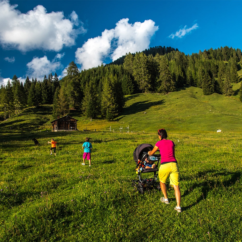
Baby trekking - Baby bike
In Val Fiorentina there are numerous walks where families with children can immerge themselves in nature without difficulty. These itineraries are filled with nature with meadows and grazing animals and take families to farmsteads and mountain huts around Selva di Cadore.
The starting point is from the first hairpin bend after Staulanza Pass towards Zoldo. The dirt track winds through enchanting landscape surrounded by nature. Being flat it is particularly suitable for small children and families with strollers. Along the route to the Malga Fontanafreda Farmstead and the Malga Vescovà Farmstead it is possible to see animals grazing in the meadows and once you get there you can buy various typical products.
easy
Difficulty
1 h 30 min. round trip
Duration
2 km
Length
The route starts in the village of Pescul on path no.569 at the end of the car park to the chairlift. This is a nice walk in the woods on a dirt track to the Ristoro Fertazza. The walk is not difficult but do not underestimate the length. During the summer it is also possible to reach the top with the chairlift.
A trekking stroller is recommended.
easy
Difficulty
3 h 30 min. round trip to the Fertazza Mountain Hut
Duration
4 km
Length
This excursion starts in a large car park at the foot of Mount Pelmo at the third hairpin bend of the Staulanza Pass where it is possible to park the car. From here there is a dirt track that takes you first to the Malga Fiorentina Farmstead and then on to the Città di Fiume Mountain Hut where you can admire Mount Pelmo in all its majesty. The Mountain Hut is located in a large meadow area where cows graze. The track is also accessible with a stroller.
easy
Difficulty
2 h round trip
Duration
3 km
Length
This circular cycle path in Palui, used in the winter by cross-country skiing enthusiasts, winds through paths and roads among cows and horses taking bikers and walkers to the Aquileia Mountain Hut from the picnic area in the village.
The track starts on the left near the car park at the beginning of the picnic area. From here cross a small footbridge over to the right side of the Fiorentina stream, cross through the entire picnic area and return to the main road for a short stretch. After a few metres turn left and go into the woods. Here the track starts to go uphill slightly and then you turn right, cross over a bridge and arrive at the Aquileia Mount Hut. From the Mountain Hut for those who wish to do so it is possible to continue the circle along the plain at the foot of Mount Pelmo. Once you return to the Mountain Hut take the same way down but before reaching the main road turn right and continue along the Fiorentina stream until you reach the starting point. This excursion is suitable for older children and families and adults with minimal training.
medium - easy
Difficulty
2 h round trip
Duration
4 km
Length
Playgrounds
In the village of Santa Fosca near the sports centre there is a playground for small children. Swings, slides, seesaws, a mini-zip line and lots more will allow families to spend a few peaceful, fun hours. Nearby by there is a restaurant and the possibility to use the sports centre.
There is also a small children’s playground on Mount Fertazza. You can take the path from the village of Pescul or alternatively the two chairlifts that go to the top of the mountain. At the top there are two mountain huts.
Selva di Cadore Ski lifts
We have collected a list of the ski lifts that are also open in the summer in Val Fiorentina.
The “Pescul - Fertazza” and “Sotto cima Fertazza” chairlift:
Ski lifts in Civetta
Ski lifts in the Cortina area
Ski lifts in Alleghe
Ski lifts in Arabba - Marmolada
Bike hire
Ski-Bike Service Lorenzini-Pescul
Mountain bike hire that also provides an assistance and repair service
Alpine Guides and Hiking Guides
Val Fiorentina is located in the heart of the Dolomites with breath-taking scenery where the expert Civetta Group Alpine Guides do various sporting activities.
With the support of the Alpine Guides, you can explore these mountains in complete safety. There are various activities to choose from: excursions in the mountains, via ferratas, rock climbing, climbing and various specialised courses.
Gianni Caronti - Alpine Guide
+39 348 2925006
Daniele Geremia - Alpine Guide
+39 340 3788018
Luca Lorenzini - Hiking Guide
+39 346 1729013
Luca Caronti - Alpine Guide
+39 347 7061543
Sports centre
The sports centre is in the village of Santa Fosca where it is possible to do all kinds of sports with a fantastic panorama of Mount Pelmo.
At the sports centre there are:
Opening hours (from 23 July to 31 August 2025)
From Monday to Friday: 9.00 a.m. - 12.30 p.m. and 3.00 p.m. - 6.00 p.m.
Saturday and Sunday: 9.30 a.m. - 12.30 p.m. and 3.00 - 7.00 p.m.
Tuesday pick up the key at the Baita Al Sole
For the summer opening period contact the Pro Loco Val Fiorentina on the following number: +39 0437 720243
1 artificial turf
7 a-side football pitch
2 Tennis courts
1 Volleyball and Basketball court
1 Indoor sport climbing gym
Picnic area
In “Ai Palui” there is a large beautiful private green area equipped for picnics next to the Fiorentina stream with direct access from the main road leading from Selva di Cadore to the Staulanza Pass.
In the picnic area there are several barbecue areas and tables in the shade of fir trees next to the Fiorentina stream. Nearby there are cows and horses grazing freely in the pastures.
Opening Hours
The area is open every day from 10.00 a.m. to 5.00 p.m. with an attendant on site
Cost
To use the area costs euro 2.00 (for those over 12 years old)
To use the tables costs euro 4.00
To use the barbecue costs euro 8.00
Available for users: toilets, wood for the fires and grills
Info and reservations
Mr. Giunio
+39 331 4233517
Mushroom picking
The woods and pastures in Val Fiorentina are full of mushrooms such as chanterelles, porcini, parasol mushrooms and many other varieties. It is possible to pick mushrooms along the paths in the valley among the fir and larch trees.
Before going into the woods to pick mushrooms we suggest you read the mushroom picking regulations, and some tips and advice about picking mushrooms and respect for the woods.
Mushrooms permits can be bought from the Tourist Office.