
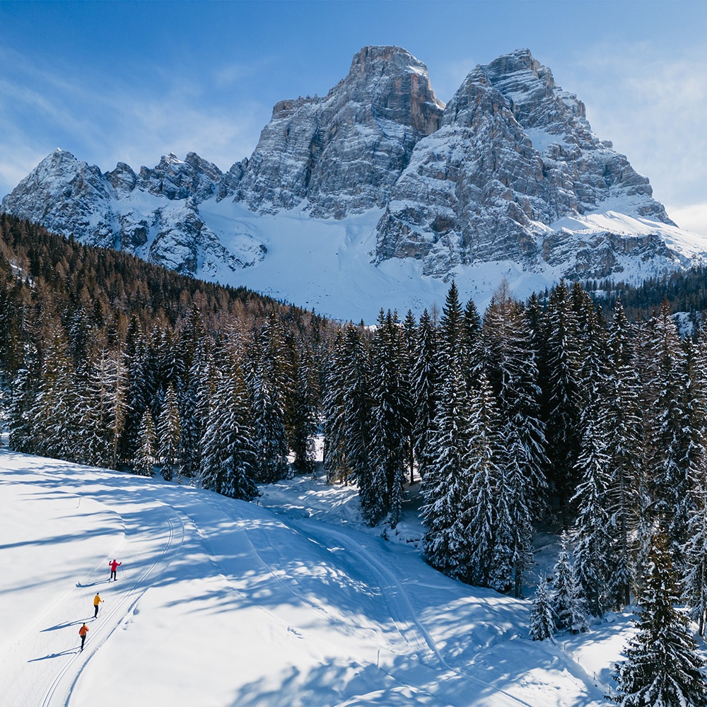
Val Fiorentina in the winter
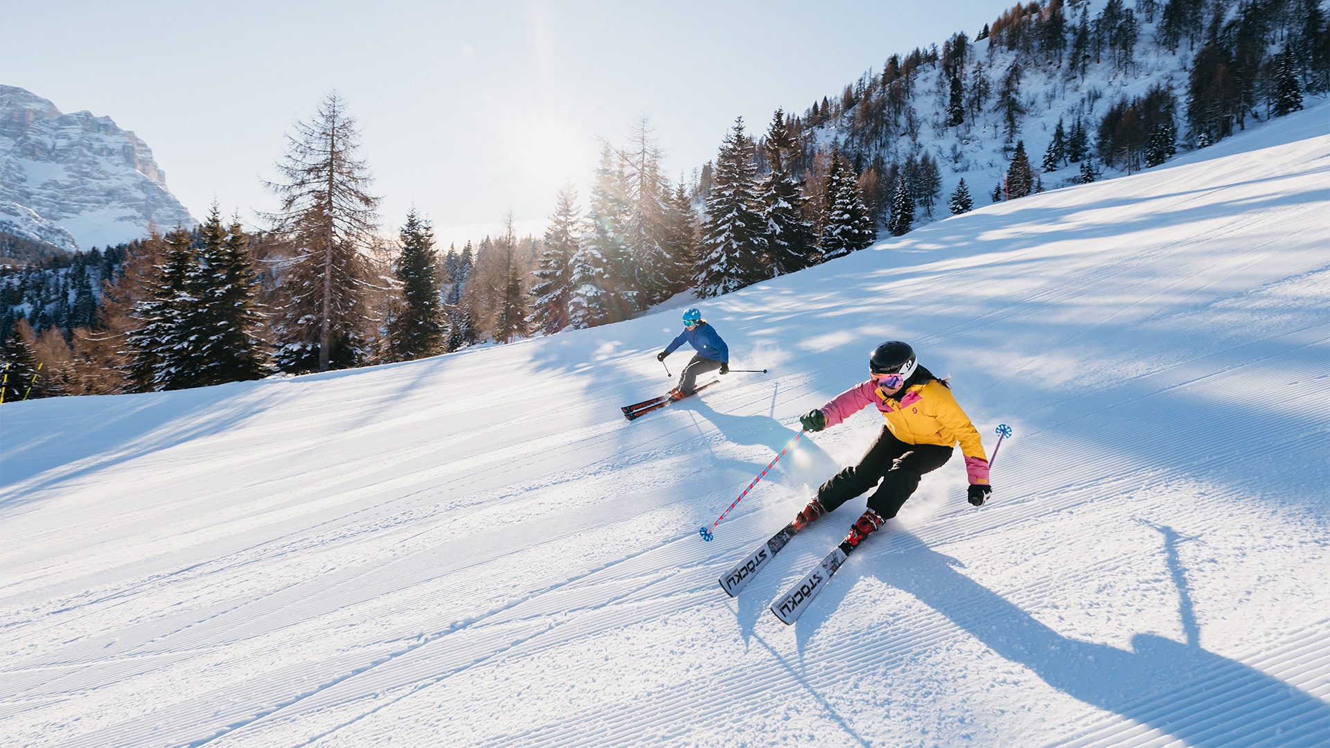
Civetta Ski Area
Selva di Cadore in Val Fiorentina is part of the Ski Civetta ski circuit, the largest in the Veneto region with 80 km of ski slopes, two of which are illuminated for night descents, and has a cross-country skiing centre with 4 circuits of various difficulty levels. All slopes are prepared for programmed snowmaking and are for skiers of all levels.
Departure in Val Fiorentina is from the ski lifts in the hamlet of Pescul, where you can quickly access the entire area with the two four-seater chairlifts. The Civetta circuit is also part of the Dolomiti Superski area with its 450 ski lifts and 1,220 km of slopes and an hourly transport capacity of 620,000 people/h.
-
1000 - 2101 m
Altitude
-
80 km
Slopes
-
Easy 51%
Difficulty level
-
Medium 43%
Difficulty level
-
Difficult 6%
Difficulty level
-
40
Ski lifts
-
20 km
Cross-country slopes
-
6
Ski/snowboard schools
-
18
Ski and snowboard hire
-
1
Skating rinks
Skiing in the Civetta Ski Area
The Civetta Ski Area offers an exceptional skiing experience. Slopes for all levels, night skiing, Dolomiti Superski, Nordic skiing, mountaineering and a ski school.
Discover your adventure in the snow!
A Skibus service is active every day that connects the circuit with the Grande Guerra Ski Tour and the Lagazuoi - 5 Torri - Giau Pass Ski Area.
-
Alleghe
0437 523544
0437 523185 -
Selva di Cadore
0437 720184
0437 520000 -
Palafavera
0437 789472
0437 788916 -
Zoldo Alto
0437 789295
0437 788648
Hiring equipment is a convenient and economic solution. In Selva di Cadore in Val Fiorentina there are many ski hire points with an extensive choice for both families and extreme skiers.
Ski hire points in Val Fiorentina also provide a repair service and hire snowshoes, cross-country skiing equipment, ski mountaineering equipment and taboggans, everything you need to spend a winter holiday in Val Fiorentina among the Dolomites filled with fun outdoor activities at the foot of Mount Pelmo
-
Pescul
Ski & Bike Service Lorenzini
-
S.Fosca
Sciovie S.Fosca
Opening hours for the illuminated slopes are: 7:30 p.m. - 10:30 p.m., Thursday, Friday and Saturday.
During the Christmas and Easter holidays they are open every evening unless otherwise indicated.
Ski School
The Ski School in Val Fiorentina is made up of expert instructors who, in addition to help improving individual technique, are able to liven up the days on the ski slopes with fun exercises and activities for all those taking part in courses.
Furthermore, the Ski School in Val Fiorentina can also provide video footage, race tracking and elite training sessions with maximum professionalism and on request take people around the Grande Guerra Ski Tour which winds through a fairytale landscape around Mount Col di Lana. For small children and beginners there is a ski school in the centre of the hamlet of Santa Fosca, with an adjacent toboggan run and an inflatable snow park.
Lessons are mainly on the ski slopes in the Civetta Ski circuit, with meeting places in the hamlet of Pescul or the school in Santa Fosca. The Scuola Italiana Sci Val Fiorentina is located in Selva di Cadore, in Santa Fosca.
information & bookings
Office hours: from 8:30 a.m. to 12:00 p.m. and from 4:00 p.m. to 7:00 p.m.
Santa Fosca Ski School
The “Campetto” Ski School is ideal for small children and beginners taking their first steps on the snow. It is just below the main square in Santa Fosca. Here instructors from the Val Fiorentina Ski School organise ski courses and lessons for beginners.
It is an ideal place for families to spend the day peacefully enjoying spectacular views of Mount Pelmo thanks to the solarium bar at the Baita al Sole, the inflatable snow park and the toboggan and bobsledding run, where small children who are too young to try skiing can have fun on the snow.
Civetta Snowpark
For the last few years, the Ski Civetta circuit has provided two snow parks specially set up for freestylers and all those crazy about snowboarding and for all enthusiasts to have the opportunity to try their hand at it.
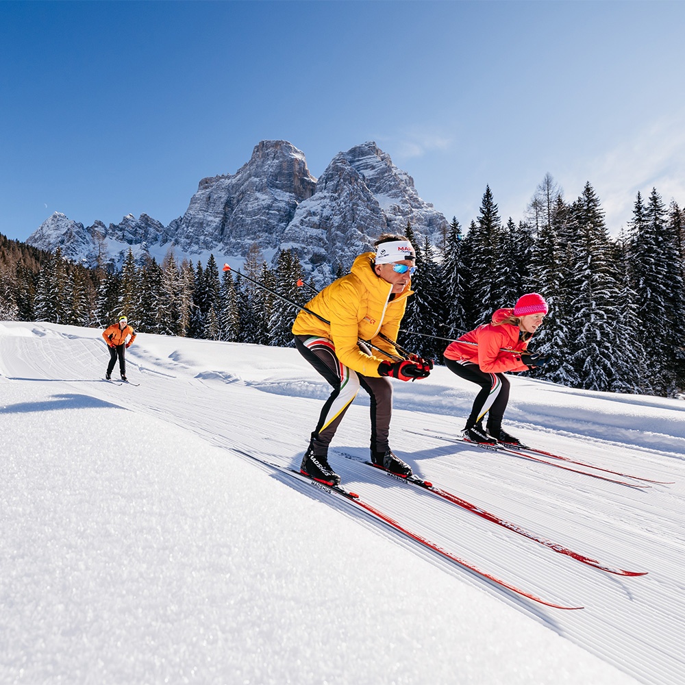
Alpine and Nordic skiing
When we think of skiing, we often think alpine skiing, yet in addition to this there is cross-country skiing, or Nordic skiing, which is the original and oldest form of the sport. Nordic skiing started in Northern Europe (Scandinavia and Russia), where it developed out of necessity. It was used to cross snow-covered terrain while hunting, collecting wood and for social occasions.
There are a lot of good reasons to do this sport given that Nordic skiing provides an invigorating and stimulating cardio workout as well as moments of relaxation and fun surrounded by nature. Get closer to the world of alpine skiing and Nordic skiing in Selva di Cadore in Val Fiorentina.
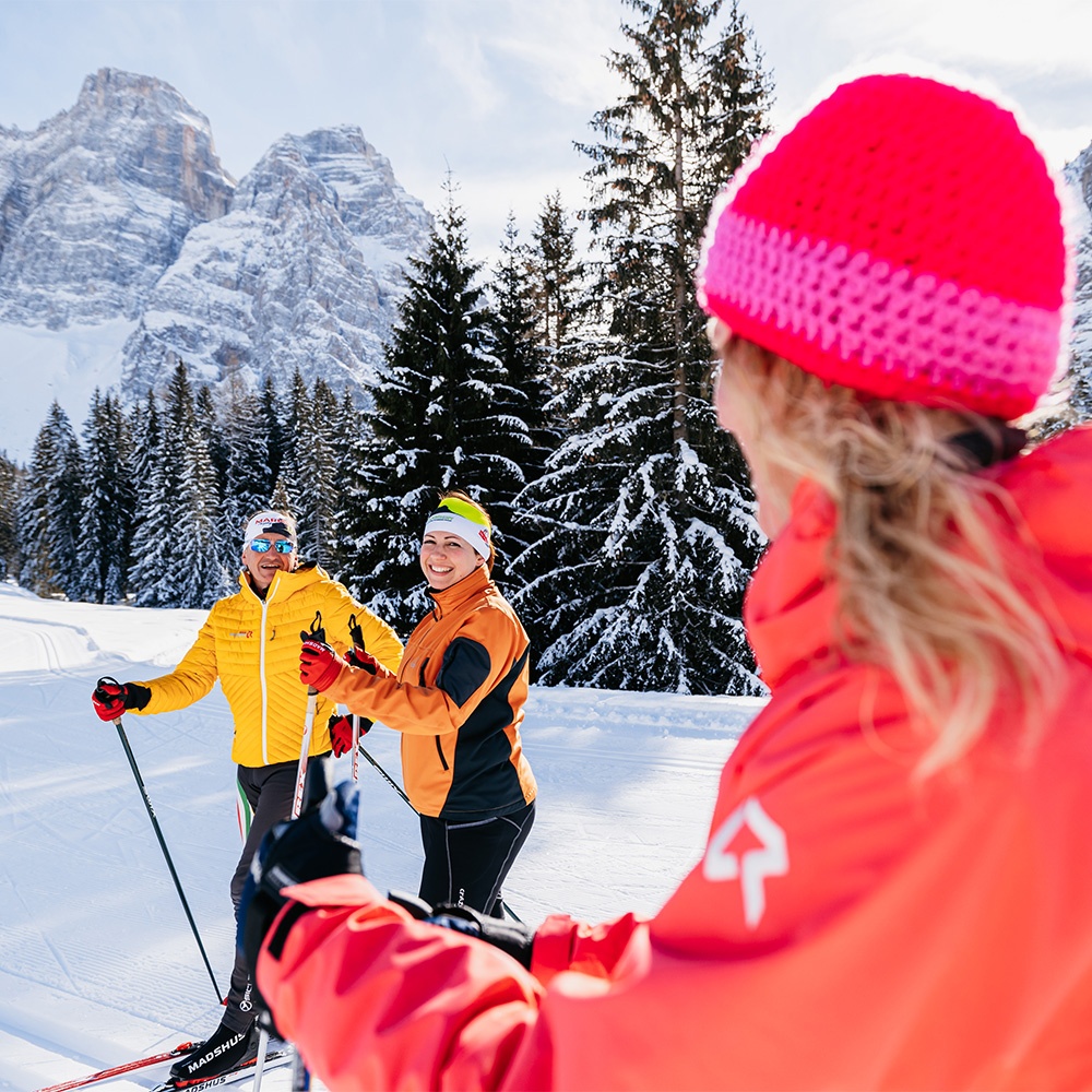
Peronaz Cross country skiing centre
For those who love Nordic skiing Val Fiorentina has a fantastic centre with 4 different circuits immersed in the silence of nature at the foot of Mount Pelmo with breath-taking scenery over the north face of the “Caregon” of the Dolomites, a UNESCO heritage site.
The circuits are in the village of Peronaz at an altitude of 1,600 m asl and excellent snow conditions are guaranteed from December to April. The Peronaz cross-country skiing centre is well equipped with changing rooms, showers, toilets, ski hire, ski storage, a repair centre and snowshoe hire.
The Aquileia Mountain Hut is just a short distance from the first circuit and provides refreshments and accommodation.
-
2 km
Easy route
-
3 km
Medium route
-
5 km
Medium-difficult route
-
7 km
Difficult route
Giampaolo Bonifacio
Cross-country skiing instructor
+39 339 8180914
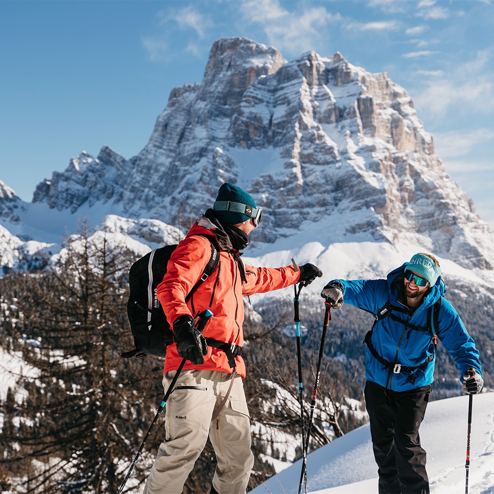
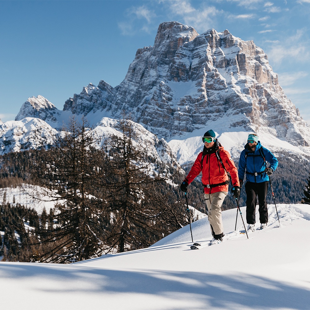
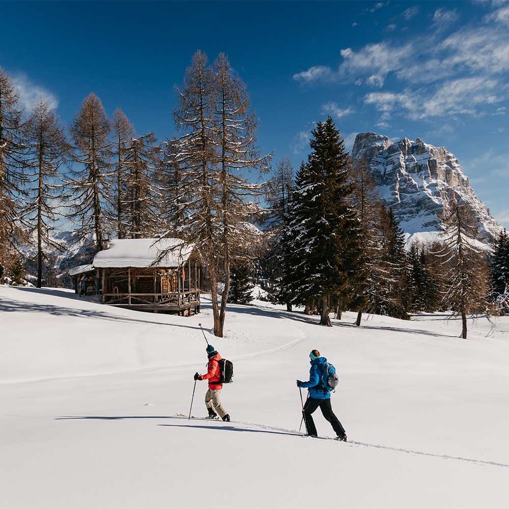
Ski Mountaineering
In the last few years ski mountaineering has become a very popular sport in Val Fiorentina and elsewhere; it is an excellent way to do skiing in close contact with nature. This activity combines the pleasure of ascents and descents and the possibility to experience thrilling moments in the silence of the snowy valleys while admiring the unique scenery, like the snow topped peaks of the Dolomites.
Every peak and valley are a destination for ski mountaineering enthusiasts.
Val Fiorentina with its special position with the mountains surrounding it is a particularly popular place for ski mountaineering enthusiasts and there are lots of different itineraries with various levels of difficulty suitable for experts and beginners.
Before setting off on an excursion take a look at the weather/snow forecast, wear suitable clothing and take equipment such as a shovel, a probe and an avalanche beacon and request information from the Alpine Guides if necessary.
Ski Mountaineering Excursions
Here is a list of the most beautiful ski mountaineering excursions in Val Fiorentina
This itinerary starts from the enchanting hamlet of Pescul where the ski lifts are, and leads to Mount Fertazza, and is perfect to enjoy a few hours of complete relaxation in the snow-filled winter woods. The route is about 6 km long with non-demanding slopes. From the car park next to the ski lifts take the small road on your left (path no. 569) which then goes into the woods. The route is clearly visible and well signposted and leads first to Ristoro Fertazza and then climbs up to Ristoro Belvedere.
Descent is along the ski slope that leads to the centre of Pescul.
-
easy
Difficulty
-
6 km
Length
-
2 h one way
Walking time
An itinerary with a high scenic value, of medium difficulty given the length. Starting from the centre of L’Andria, this route initially follows a road for about an hour that leads to Piera de L’Autà or alternatively you can start from the beginning of the cross-country ski slope after Pescul. From here go left in a north-west direction passing by the Malga Mondeval de Sota Farmstead and climb until you reach a snow-covered valley in Mondeval de Sora. After passing the Mondeval de Sora dairy farm where you can stop to have a break, continue west, north-west crossing the snow-covered meadows on a slight slope until you reach the fascinating Lake de le Baste. Here take a sharp left (south) following the short ridge, on a moderate slope that leads to Mount Corvo Alto - Mount Mondeval. Descent is on the same route as the ascent with the alternative of a few pleasant variations that are possible due to the vastness of the almost flat valleys and snow-covered meadows.
-
medium - difficult
Difficulty
-
4h 15 min. - 4h 45 min.
Walking time
After leaving the car park at the 3rd hairpin bend on the road to the Staulanza Pass, go through the metal gate and after about 1.5 km you reach the Malga Fiorentina Farmstead (closed in the winter). From here you start to get glimpses of the wonderful panoramic views. Continue on the well-marked road that veers to the right, heading east and after walking about one kilometre slightly uphill you reach the Città di Fiume Mountain Hut. From here, after a rest take the path on the right (east), which is also well signposted in the immaculate snow where vertical signs indicate the way to Forcella Forada and Val d’Arcia. After a short path of less than 1 km in the middle of a sparse wood you reach the ridge, the destination of the excursion. Descent can be by the same route or if the snow cover is stable, descend the Forada valley staying high along the rocks of val d’Arcia all the way back to the starting point.
-
easy
Difficulty
-
2 h - 2 h 30 min.
Walking time
The itinerary starts at the car park at the 3rd hairpin bend climbing towards Staulanza Pass. Leave the car in the car park and climb directly onto the steep snow-covered screes at the base of Mount Pelmo. Once you almost reach the summit of the scree continue left where, approximately at the height of the Croda di Forada, halfway along the route the large snowfield narrows, and Val d’Arcia can be seen isolated and wild, wedged to the east between the crags of Forca Rossa, the slopes of Mount Pelmo and Mount Forada to the west. Here fatigue starts to put you to the test, but looking up towards Forcella you are persuaded and encouraged you to continue on the steep path.
At the top of the windy Forcella at an altitude of 2,476 m above sea level, a wide panorama opens up over the Boite Valley with Mount Antelao and the Cadorine and Zoldane Dolomites.
This is a challenging route only suitable for expert skiers who, in addition to the charm of the fabulous Dolomite environment want to experience the thrill of the descent, zigzagging in the fascinating, deep snowfields of two beautiful Dolomite giants Mounts Pelmo and Pelmetto. The exhilarating descent along the same route as the outward journey amply repays the effort.
-
difficult
Difficulty
-
3 h 30 min. - 4 h
Walking time
This exciting itinerary, of medium difficulty due to its length, starts from the charming hamlet of Toffol, where you can stop to admire the characteristic houses and haybarns of the ancient and intact rural architecture; here time seems to have stopped a long time ago. In Toffol take the first road on your right before the bridge over the Loschiesuoi stream where a wooden sign indicates the way to “Mondeval”. After about 1 km you pass by the Malga “Pien de Vacia” Farmstead, continue for a further 2 km to come in sight of the large bridge over the Cordon stream where there is an ARPAV station (Regional Agency for Environmental Protection and Prevention of Veneto). About ten metres before it, immediately to the left, there are vertical signs indicating “Mondeval” and three boards containing information about the local area and the archaeological discoveries in Mondeval. The route continues to the north, north/east. After less than one km you pass in front of the Mondeval di Sotto dairy and continue slightly uphill for less than one km. You then cross the Rio de Mondeval stream where the route becomes steeper and continues north to Mondeval di Sopra. Once you reach the top of the hill with a view of the Rocchette turn right in a north/east direction and then climb sharply up the slope that leads to Col Duro (2,383 m asl) where you can enjoy a true spectacle of nature. The descent is pleasant down the same route.
-
medium
Difficulty
-
6 km circa
Length
-
4 h - 4 h 30 min.
Walking time
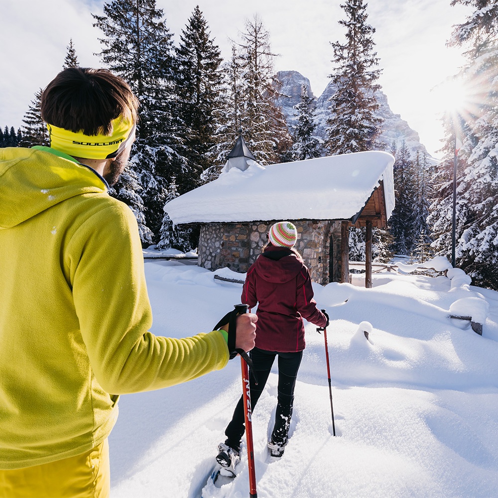
Walking and Snowshoeing
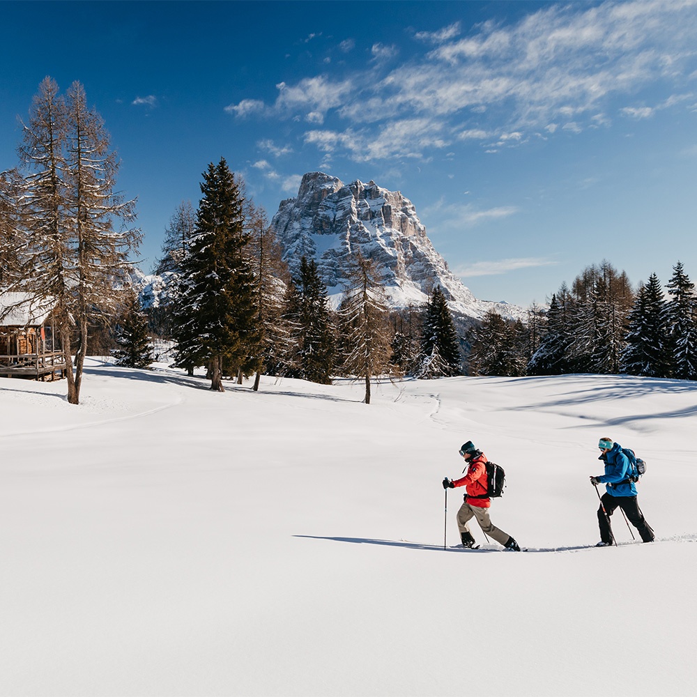
In the winter it can be difficult to leave the house and abandon the warmth of the stove, but in Selva di Cadore there are lots of opportunities to move and appreciate the wonderful landscapes. Walks and excursions for adults and children can be found across the entire area of Val Fiorentina. You can discover the most evocative corners of the valley with its ancient hamlets and magical places with snowshoes or on foot. Snowshoe excursions are organised during the winter season.
Before taking off on an excursion take a look at the weather/snow forecast, wear suitable clothing and take the necessary equipment. Ask for information from the Alpine Guides if necessary.
WARNING IT IS FORBIDDEN TO WALK ON THE SKI SLOPES!
There is a Skibus service on the following routes:
Pescul - Santa Fosca - Selva di Cadore - Fedare (Giau Pass)
Return ticket € 5.00
Information and times: available at the Tourist Office in Selva di Cadore
The route starts at the 3rd hairpin bend leading to the Staulanza Pass on the Selva di Cadore side towards Val di Zoldo, where a large car park can be found on the left. The route that leads to the Città di Fiume Mountain Hut is also suitable for beginners and provides a perfect opportunity to enjoy the splendid panorama of the most famous peaks in the Dolomites. The route that can be travelled on foot or with snowshoes continues under the shadow of Mount Pelmo and once you reach the Mountain Hut you can see: Mounts Pelmo, Marmolada, Croda da Lago, Lastoi del Formin and Civetta. The first destination along the route is the Malga Fiorentina Farmstead where you can get a first glimpse of the panoramic views over Val Fiorentina. From here continue towards Città di Fiume keeping right: the entire route takes about 1 h to walk. Once you reach the Mountain Hut, we recommend you continue for a short distance on the right until you get to Forcella Forada, where you can experience the thrill of being just a short distance from the slopes of Mount Pelmo.
For more expert walkers once you reach the Mountain Hut there is the possibility to continue on towards the Malga Prendera Farmstead where you can enjoy a day in the spectacular winter scenery.
-
easy up to the Città di Fiume Mountain Hut
Difficulty
-
1 h to the Città di Fiume Mountain Hut
Time
-
2 h 30 min. to the Malga Prendera Farmstead
Length
-
2 km to the Città di Fiume Mountain Hut
Length
-
5 km to the Malga Prendera Farmstead
Length
-
On foot, Snowshoes, Ski mountaineering
Accessible
The route starts in Pescul to the right of the chairlift where a road leads to Mount Fertazza. CAI path no. 569 starts directly from the car park. The first part of the itinerary is well-trodden in the winter season and is suitable for walking with or without snowshoes. The path follows a forestry-pastoral road that leads into the woods and gives you the possibility to spend a few hours in complete relaxation in the evocative snow-covered landscape. The first part of the path leads to the Fertazza Mountain Hut at an altitude of 1,839 m above sea level, for those interested 100 m before the Mountain Hut on the right there is another path that initially continues in the woods and then goes past some wooden huts to reach Ristoro Belvedere at 2082 m above sea level, just a short distance from Mount Fertazza. From this altitude you can admire Val Fiorentina and all the breath-taking peaks in the Dolomites like the North Slope of Mount Civetta, magnificent Mount Pelmo and in the distance the Sella Group, Mounts Marmolada, Averau and Cernera.
The route provides the possibility to ascend/descend easily with the 2 chairlifts which provide an excellent alternative for those who only want to do part of the route.
-
easy-medium
Difficulty
-
1 h 45 min. to the Fertazza Mountain Hut
Time
-
2 h 45 min. to the Ristoro Belvedere
Time
-
6 km
Length
-
on foot, Snowshoes, Ski mountaineering
Accessible
The road that leads to the Malga Fontanafreda Farmstead starts at the 1st hairpin bend after the Staulanza Pass on the Zoldo Alto side. The completely flat route leads through charming scenery amid the silence of the woods and pastures covered in powdered snow. Just before you reach the destination you reach a crossroads where you can make a deviation and continue left to reach the Malga Vescovà Farmstead. Following the classic route, you reach the Malga Fontanafreda Farmstead at an altitude of 1,768 m above sea level. Here you can take a rest and enjoy the sun in the large sunny space surrounded by Mounts Pelmo and Civetta. The route is not difficult and is even suitable for families with small children.
-
easy
Difficulty
-
45 min.
Time
-
2 km
Length
-
on foot, Snowshoes, Ski mountaineering
Accessible
The excursion starts in the charming hamlet of Toffol just above the village of Santa Fosca. The route starts on the right just before the bridge over the Loschiesuoi stream and winds along a small road at the foot of Piz del Corvo. The first part slightly uphill leads to the Malga Pien de Vacia Farmstead. Once you reach the farmstead continue towards Mondeval via a flatter route, while those who want to return to the village can take the path on the right that leads back to Santa Fosca. Continuing on you quickly reach the village of Piera de l’Autà di Mondeval at an altitude of 1,756 m above sea level where more expert walkers can take the path towards Mondeval De Sora. Once you pass over the bridge over the Cordon stream you start descending on CAI path no. 466 that crosses through a splendid fir tree wood to reach Palui at the crossroads with main road 251. Just before the crossroads on the right a path leads to Pescul, from here you can proceed along the main road to return to the starting point.
-
easy
Difficulty
-
3 h 30 min.
Time
-
7 km
Length
-
on foot, Snowshoes, Ski mountaineering
Accessible
This walk starts from the ancient hamlet of L’Andria 1,468 m above sea level where you can still admire the traditional haybarns and characteristic houses from the past. Once you pass by the charming church of St. Oswald, turn right where there is a short but steep climb which then levels out at the beginning of the woods that overlooks the whole of Val Fiorentina. Cross the Rio Stretto stream and continue to the crossroads for Pien Darè at an altitude of 1,650 m above sea level where if you turn left the path takes you down to the village of Franceschin 1,453 m above sea level where you can reach the departure point easily. For those who want to extend the walk at the crossroads for Pien Darè continue straight on to reach the village of Zardin at an altitude of 1,444 m above sea level in Selva di Cadore.
-
easy - medium
Difficulty
-
1 h 45 min. to Franceschin
Time
-
2 h 45 min. to Zardin
Time
-
2 km to Franceschin
Length
-
4 km to Zardin
Length
-
on foot, Snowshoes, Ski mountaineering
Accessible
This beautiful walk suitable for expert and trained walkers takes you to the place of the burial site of the Mondeval Man, a hunter who lived about 7,500 years ago whose perfectly preserved skeleton and funerary objects can be seen at the Vittorino Cazzetta Civic Museum in Selva di Cadore. The excursion starts from the left side of main road 251, in the picnic area in Palui at an altitude of 1,474 m above sea level, about 1 km after the hamlet of Pescul. From here take path number CAI 466 that goes up through the woods to reach the village of Piera de l’Autà, near the ARPAV station at an altitude of 1,756 m above sea level. After the ARPAV station continue right on path no. 466 on a slight climb through the pastures. First you pass by the Malga Mondeval di Sotto Farmstead and then you cross over the Cordon stream again where the path starts to climb up a steep slope to reach the Mondeval de Sora basin at an altitude of 2,158 m above sea level where the Mondeval Man was discovered. Here you can also find a shelter. The route is fantastic thanks to the panoramic views and uncontaminated landscape immersed in the quiet of nature. From the Mondeval de Sora basin you can admire the splendid peaks of the Dolomites: Lastoi de Formin, Croda da Lago and Becco de Mezodì, Civetta and Pelmo. More expert and physically trained walkers can continue onto the top of Lastoi de Formin or Col Duro or cross the entire Mondeval de Sora area and descend down to the Città di Fiume Mountain Hut.
-
difficult
Difficulty
-
4 h
Time
-
5 km
Length
-
snowshoes, Ski mountaineering
Accessible
The route starts from the Fedare Mountain Hut and continues to the top of Mount Pore, a legendary mountain that was important in the past for iron extraction. The route is quite easy at first and then progresses to a challenging climb on the last stretch. Starting from behind the Mountain Hut the path continues on the left (path no. 463), to reach the ridge of Jof de Melei at an altitude of 2,140 m above sea level. This short walk is also suitable for less expert walkers and allows you to admire the beautiful panorama of the Giau Pass and the surrounding mountains. For experts and after careful evaluation of the weather and snow conditions, it is possible to continue to the top of Mount Pore. From the top of the mountain, you can admire the peaks of Mounts Civetta, Pelmo, Marmolada, the Sella Group, Averau and Nuvolau.
-
easy until Jof de Melei
Difficulty
-
difficult up to the top of Mount Pore
Difficulty
-
1 h to Jof de Melei
Time
-
2 h to the top of Mount Pore
Time
-
1.5 km to Jof de Melei
Length
-
3 km to the top of Mount Pore
Length
-
snowshoes, Ski mountaineering
Accessible
Ice Skating Rink
In the nearby village of Alleghe, around 10 km from Selva di Cadore, there is an ice rink on the shores of the lake with the same name. The rink provides everyone with the possibility to try the fun sport of ice skating and also hires equipment.
Furthermore, in both the summer and winter you can enjoy the thrills of watching ice Hockey matches of the local Alleghe team which for many years has successfully participated in the Italian National Championship - as well as watch figure skating and ice dancing shows with nationally and internationally renowned athletes.
Tourist Office in Selva di Cadore